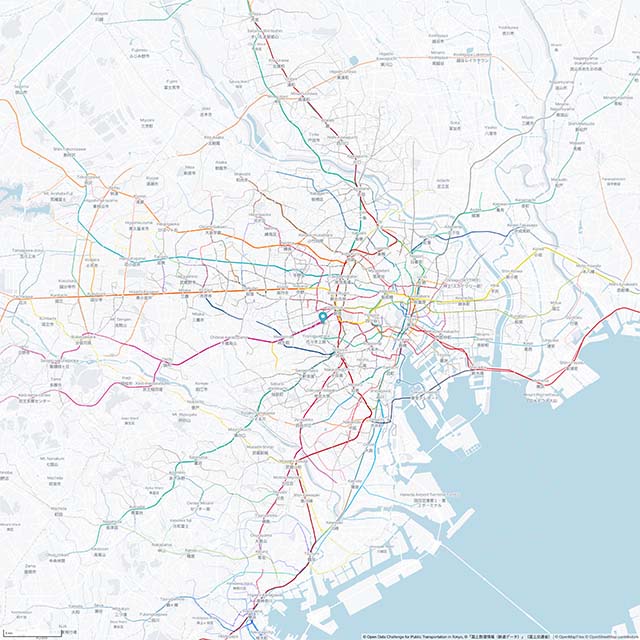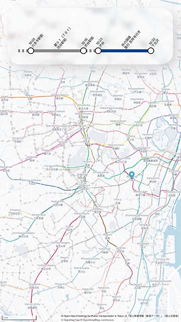
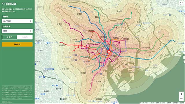
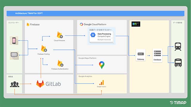
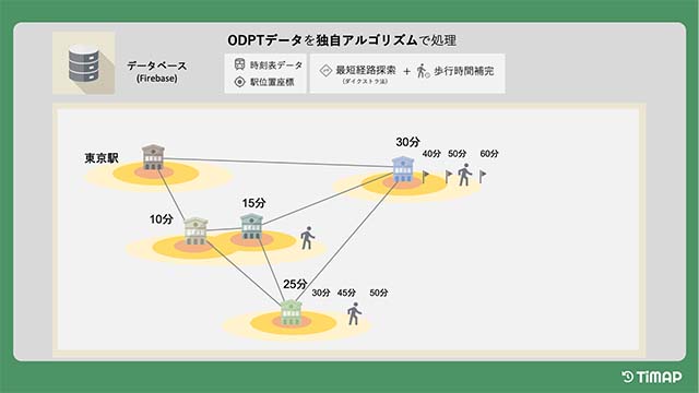
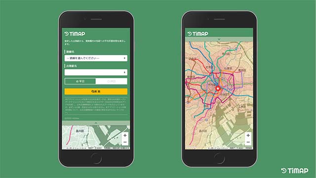
Due to the complex transportation network in Tokyo, the distance on the map does not necessarily correspond well to the travel time when we consider the selection of means of transportation and unavoidable transfers. TiMAP we propose allows you to grasp at a glance the time it takes to reach each point on the map by simply specifying the starting point. TiMAP has been implemented using a variety of cloud solutions, mainly Firebase. We use the provided open data as input and obtain the arrival time to various locations in Tokyo by performing advanced calculation based on our own algorithms on the analysis cluster built on Google Cloud Platform. This app helps tourists plan efficient sightseeing routes and select accommodations to ensure smooth travel and a comfortable stay.
In addition, we would like to provide multifaceted value not only to tourists, but also to newcomers to Tokyo who are unfamiliar with the city, such as those who are relocating to Tokyo, by helping them choose an appropriate place to live, considering the location of their office or school.
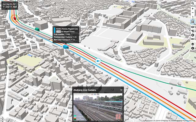
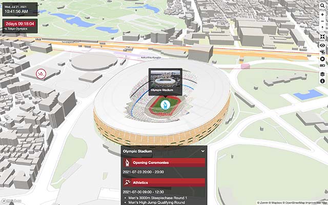
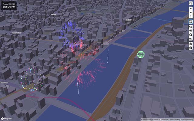
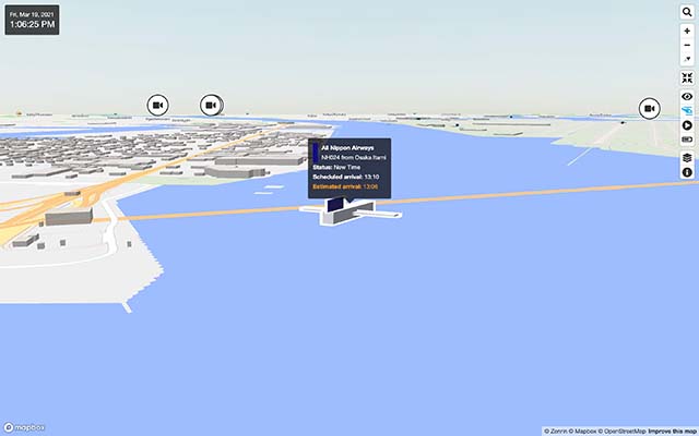
Mini Tokyo 3D 2021 is the latest version of real-time 3D map of public transportation system in Tokyo. Staring with the previous work "Mini Tokyo 3D," this new app has made great progress over the past two years. In addition to the original goal of "helping visitors in Tokyo understand its complex public transportation network and stay comfortable,” Mini Tokyo 3D 2021 incorporates various ideas in the wake of the COVID-19 pandemic in 2020 so that people all over the world who cannot visit Tokyo can enjoy today’s Tokyo “in real time.”
The features of Mini Tokyo 3D 2021 are as follows;
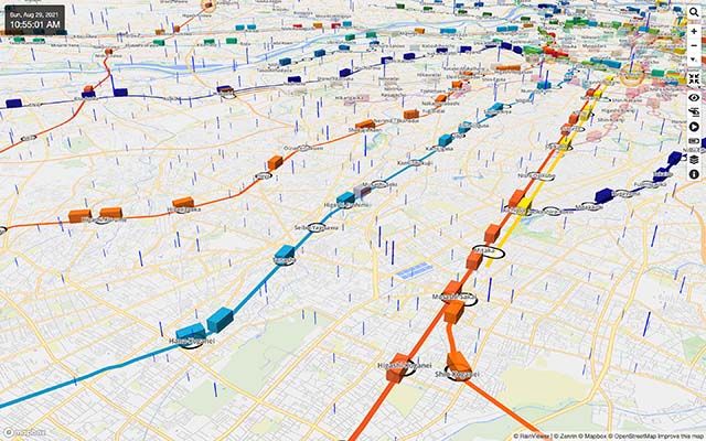
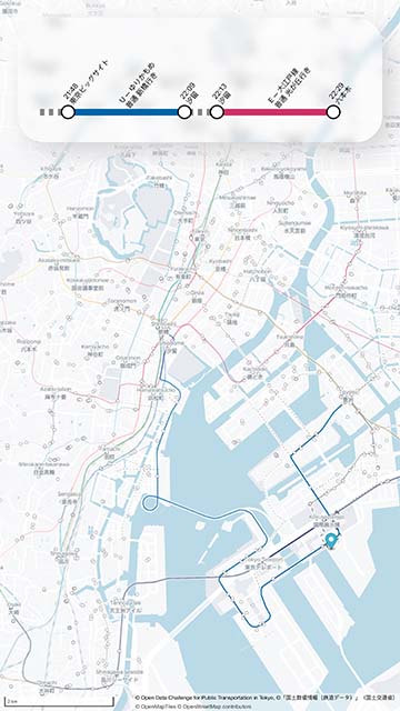
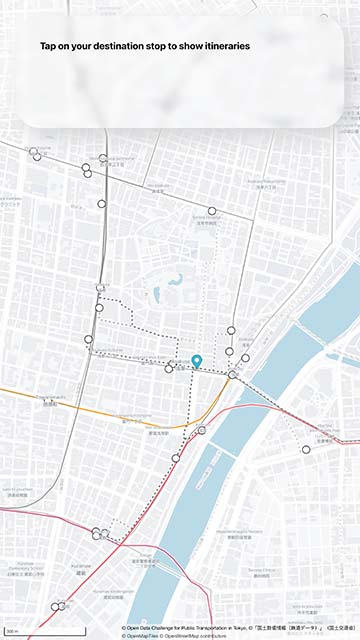
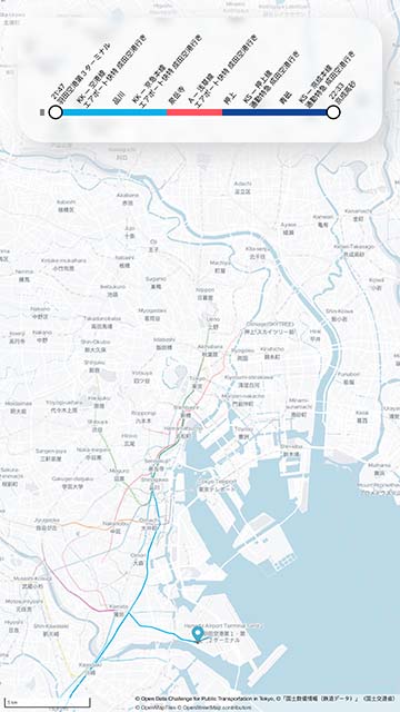
Tokyo LIVE Route Map is an app that visualizes the current movement of public transportation in Tokyo. The app creates a real-time route map based on the user's location and calculates the best way to reach any public transportation stop in Tokyo. As soon as the user taps on a destination, the best way to reach there will be shown.
The idea to develop this app came from a story of a friend who missed the last train to go home. He searched on a major map app and got only results telling him to wait until the next morning. By visualizing transportation options, the app makes it easy for users to see what routes are possible and if they are currently available. In my friend's case, he reached a nearby train station and walked from there.